Got Milk?

Today was all about dairy farms, as I rode from Hammett, Idaho to Heyburn, Idaho on the plains north of the Snake River.

In the back of my mind, I like to think that my dairy products come from cows munching on grass in beautiful pastures. Something like this shot from early in the day.

51tOFBgURciiwQ0mUK63Yw.jpg

But I know the reality is that most dairy farms look more like this.

jvPB+qyvT7m4FPJm%D5iZw.jpg

I passed miles and miles of feed lots like this one. The cows are lined up with their heads through a grate (they can easily move in and out of the grate) and forage is spread out along the row in front of them. As I rode along lines of cows like these, they would lift their heads as I passed by, looking quizzically at me before returning to their feed.

I also passed many fields growing the alfalfa that was turned into feed:

XU2cxZTMTTSXpvN7ZlY%ag.jpg

And huge covered mounds of forage ready to be trucked to the feed lots. I was also passed by fair number of trucks full of forage!

3TubHETHTliNZ%25dF17FAzw.jpg

We arrived at our RV Park adjacent to the Snake River about 2:00 this afternoon, just as thundershowers were spreading over the area. The showers missed us, but it was dark and windy for several hours as we ran errands and found dinner in the nearby town of Burley.

The evening cleared after dinner giving us a beautiful view of the wide part of the Snake River just outside our RV, and the still snow capped Albion Mountains to our south.

uiUjSexcQj+PYQSU76Dc3w.jpg

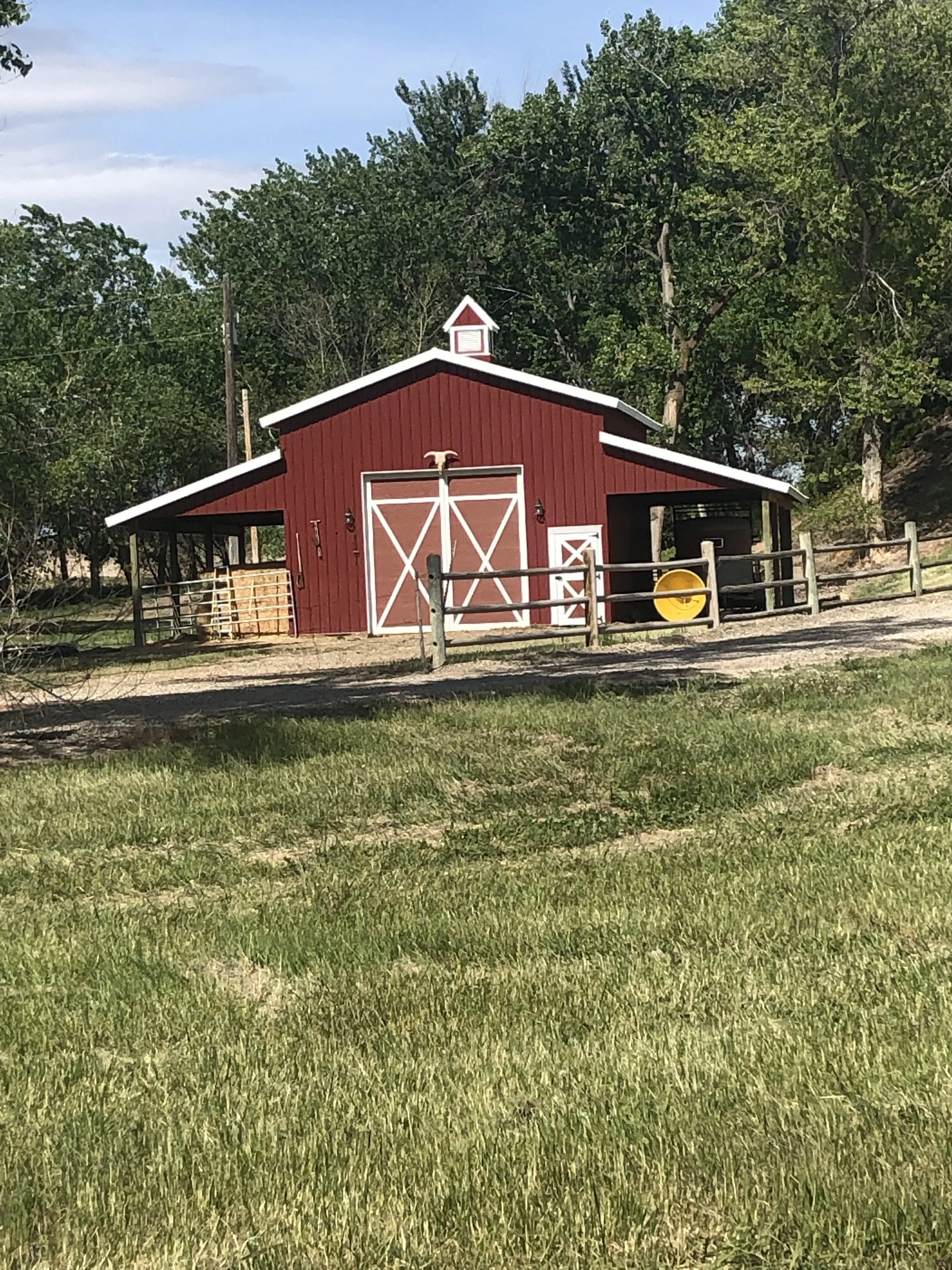
Here is today’s barn — the only one I saw all day, just a few miles after I started.

kTyr40UdTkWMxGXQRFTJPw.jpg

I also put in a guest appearance today on “The Conversations” blog. Read about Bill RIngert, a former Idaho State Senator and current winery owner here.

The technical stuff:

81.2 miles

2,606 feet of climbing

Average speed 15.4 miles per hour

Weather: Partly cloudy with high hazy clouds in the morning and thundershowers in the area by late afternoon. Low 50s at the start and low 80s at the end. Light winds were not really a factor except for a bit of a tailwind at the end of the day.

You can see the entire route to date here.

A Series of Unfortunate Events

To be clear, today’s inconveniences were all minor — the kind of thing that is expected on any given day on a bicycle ride. But they didn’t all have to happen today on the shortest ride of the trip so far!

First there was the bridge that was out in the first few miles of the ride. The detour was about a mile of a jarring and dusty gravel road, with a few large trucks passing by for good measure.

To add insult to injury, the bridge repair was complete, they just haven’t reopened the road yet. As I rejoined the road, a vehicle came across the bridge, and drove around the “road closed” sign and proceeded along its way. I easily could have done the same, had I only known.

Then Toni, who was driving the interstate that ran parallel to my route, was unable to exit where we had planned to rendezvous. I told her that was fine, I could just meet her at the next town another 10 miles down the road (at least we had good cell coverage all day).

Then I promptly suffered a flat tire. I replaced the flat rear tire in no time, and glanced at my front tire and noticed that it was too soft to ride on. I had no more spares, so I re-inflated it and hoped for the best. That worked well enough, but I had to stop three times to reinflate the tire before I met Toni 10 miles later.

Then, just before I met up with Toni, I encountered this:

GrHKlNz+TH+MawE%WHRYjg.jpg

Having learned my lesson earlier in the day, I forged ahead. I had to grind through about a quarter mile of gravel at the construction site, but then was able to walk up to the road bed at the bridge, which was old but ridable, and rode on.

The next stop was the town of Bliss.

uO8AnHGVRzejEJiwEkjoxw.jpg

I briefly entertained the hope that I had indeed entered bliss and my inconveniences for the day were over, but then two unleashed dogs ran out to greet me. They probably were friendly enough, but nevertheless were intent on complaining that I was on their territory, and gave chase. They quickly gave up the chase though, as I accelerated away from them.

In Bliss I was able to change my leaky tire and get another spare, and then descended down to the Snake River for about five miles right along the river. Earlier in the day, I had ridden the benches above the river.

Qp1eFF4gSLe75dlw6fpWwg.jpg

But now I descended down towards the river, which was passing through whitewater narrows at the time.

nkOlPBnMTGiZLZzOtTLa+g.jpg

Down along the river, there were houses that looked larger and better appointed than I expected out in the wilds of the Snake River. I suspect they were vacation homes for nearby Twin Falls or Boise residents. There was also this old truck abandoned off the road with its oversize bolder load.

F0PyEuc5RSOPY1ZByDHuXQ.jpg

I also encountered today’s barn. They are few and far between here in Idaho, and I’m making do with whatever I can find at this point!

iZtxldrxR+e8Wb0cY1Su%A.jpg

We arrived at our nicely shaded RV campsite — with internet connections!— about 2:00.

The technical stuff:

41.4 miles

1,826 feet of climbing

Average speed 13.1 miles per hour (gravel roads will do that to you)

Weather: Bright sunshine all day. Around 60 at the start and mid to high 80s to end. Light winds were not really a factor after brief headwinds early on.

You can see the entire route to date here.

No Place to Hide

I returned to riding after two rest days in Boise. We drove from Boise to Walters Ferry on the Snake River, and I started riding where I left the route Wednesday, just across the Snake River. I soon left the river, and turned upland to the wide open spaces of the high desert. This was the most common sign of the day:

XTgZ9g5xT3atn1G4Q2BtDw.jpg

While the sign was warning that cattle were ranging freely and could be on the road, the sign also accurately described the environment. I took several pictures of the wide open spaces, but they all looked pretty much the same:

1208mXj%TSahltr16peTdw.jpg

There really was no place to hide.

There were mountains off in the distance, and the sagebrush was broken in a few places by fields of wildflowers.

Iv3Y5L80SU6FrmIsGnQOTg.jpg

By lunchtime we had swung back to the river, and had lunch at the Snake River Diner in the town of Grand View.

Snake River Diner.jpg

We were greeted warmly by the friendly patrons of the diner, mostly locals and many members of the local Mennonite Church. Toni and I each had engaging conversations with the owner and several of the patrons, and we will be writing these up in “The Conversations” section of the blog in the next few days.

After lunch, the route followed the Snake River more closely and the land was largely agricultural, with many irrigated hay and alfalfa fields.

1UNrY8NoRK+QH7TdlQMp7Q.jpg

Just before we reached our destination in the small town of Hammett, the road followed the river closely, and this quiet beautiful stretch was the most pleasant of the day.

Lrg6HavVTs6Q5tuor%58aQ.jpg

Our destination was the Cold Spring Winery, part of the Harvest Hosts program. In the program, wineries and other farms and similar places with large spaces allow RVs to park on their property free of charge (but it is courteous to buy some of their products).

7cN9pD6ATW6mtzYydlWA5Q.jpg
UhGJ4jkASsiNceF4BYuqyg.jpg

We arrived well after the tasting rooms hours had passed, but the owner, Bill Ringert, was still hanging out in the tasting room, and after we parked the RV, we tasted through his lineup. Ringert is a former pilot, former lawyer and former Idaho State Senator, who bought the vineyard property as a hobby in 1998 and has been producing wine since 2002. After we tasted through his lineup, he opened another bottle and invited us to join him for a glass on his porch. We continued the conversation we began in the tasting room, and it deserves full coverage, so Toni and I will put together a report on that conversation in the next day or two.

Speaking of wineries, Telaya Winery, an excellent urban winery, was next to our hotel in Boise.

E9sECTq6TaGHQjUIG7TtJQ.jpg
gCyvW3twRgey3y0ioRrFZA.jpg

While Toni was busy getting the RV washed the other day, I stopped in and did a focused tasting of most of their lineup. Their wines are the best we have tasted in Idaho, and while I wouldn’t come up here just for their wines, if you are in the area, it is worth stopping in. They source their fruit from both Idaho and Washington, and produce Syrah, Malbec, Merlot, Viognier and Sauvignon Blancs (among others I didn’t taste) that were all noteworthy.

Barns are in scarce supply in Idaho. II finally found this one late in the day, but it was impossible to get an unobstructed view of it. Trust me, it was a photo worthy barn.

Dg+%5NNoTImrmOJi+BR53w.jpg

The technical stuff:

83.0 miles

3,602 feet of climbing

Average speed 15.1 miles per hour

Weather: Bright sunshine all day. Around 60 at the start and mid to high 80s to end. Light winds most of the day, picking up to slight tailwind at the end of the day.

You can see the entire route to date here.

Boy-see not Boy-zee

Locals are always particular about how their location is pronounced, and (as we are all local to someplace) I like to respect their preferences. So today I learned that Boise is pronounced “boy-see” not “boy-zee.” And so it shall be in my lexicon going forward.

We are staying at the The Riverside Hotel, and it is aptly named. Here is the view of the Boise River outside our room:

PB5eysckRsi3HMmy+nPjOA.jpg

We took advantage of our rest day and slept in this morning, but I did get a brief ride in. I rode Boise’s excellent system of bicycle paths to the nearest bicycle store and back. The paths run mostly along the river, and that’s the path at the bottom of the picture above. Here’s a clearer view of the path.

%WV10DSiQFWUrgsEO+lnGw.jpg

After the outing to the bicycle store, Toni and I walked along the path about a mile and a half to a movie theater and watched “Avengers: Endgame,” proving that you can take the lawyer out of Disney, but you can’t take Disney out of the lawyer.

After the movie we walked a few blocks to a local brewery and met Sara LaWall and Michael Alvarado, friends who had moved from Pasadena to Boise several years ago. Sara is the minister of the Boise Unitarian Universalist Fellowship, and she invited a couple of members of her church who are active cyclists to join us. Toni will be writing more about the lively conversation we had with them, but suffice it to say that we had a great time connecting with old friends and meeting new ones over local brews (no doubt including hops from the hop farms I rode through yesterday).

YmzMoxbtRYqMIK9koG%25sWw.jpg

At Sara’s recommendation, we walked a few blocks to the Modern Hotel and Bar where we enjoyed a delightful dinner in the courtyard to celebrate our anniversary.

E7%2BXCfNYTWWfGQ44l44%25EQ.jpg

And this being a rest day, that’s it for tonight!


Hello Idaho

Oregon is behind us, and we are in Boise, Idaho tonight.

Our last day in Oregon led us along a part of the Oregon Trail, where it surmounted Keyes Pass in southeast Oregon. By the standards of the passes I have gone over the last few days, Keeney Pass wasn’t much, topping out at 2,458 feet, and the climb up it was gentle and aided by a nice tailwind.

The part of the Oregon Trail I rode along was open range land, and probably doesn’t look too much different than it did in the mid-19th century.

jRm+Q8gvRX2WDc3qeQ9Gww.jpg

We entered Idaho without much fanfare. We were on back roads, and there wasn’t any sign indicating that we had passed the border, though the resurfacing project Oregon had underway abruptly ended at the border. Here was my last look back at Oregon.

6LYLIOyTS3SRwqAdGjy2gQ.jpg

Just before the Idaho border, I met up with the Snake River, which will be close to the route from here into Wyoming, and I crossed it several times today.

+NNfqkCNQ1qnjXWxuYX2Nw.jpg

The agriculture of the Snake River Valley in western Idaho is decidedly larger scale than most of what I saw in Oregon. There were fields of what I assume were onions (based on the onion processing plants I saw).

Efu5FcdCR3WezUuvvPqXew.jpg

There were also many references to beets (I assume for sugar) though none had surfaced yet. But the yellow garlic blossoms were in full bloom.

Mozj0wZwRmC6JtPBu4m52A.jpg

And there’s a prize for anyone who can tell me what is growing here.

iTFh5DA3Teqnb1WRTmeo2A.jpg

Here’s today’s barn . . .

1%R3Gp24RW+av3TvzWv1YQ.jpg

But honestly, this one is more representative of what I saw today.

clr%2BHl3eRsS216flx4rHtA.jpg

There were more turns on the route today than in the last few days combined, and sometimes following the cue sheet was a little challenging, especially when we came to unmarked roads. But sometimes, our direction was clear.

4WDlWZxFSx6%25hZ8jv%2Btm0g.jpg

We paused the ride for a couple hours to visit the Huston Vineyards. I would show you a picture of lovely grapevines in the Snake River Valley AVA, but I honestly saw none. The Huston Vineyards sources its fruit from several vineyards nearby, but my route did not take me by any of them.

After the winery visit, I headed south up the Snake River Valley to Walters Ferry, the last point on the route that is easily accessible to Boise. Toni picked me up and we drove into Boise, where we will be spending the next three nights, giving my legs a little rest and taking in Boise. Saturday morning we will drive back to Walters Ferry, and we will pick up the ride toward Jackson, Wyoming, our next resting point.

The technical stuff:

72.97 miles

2,451 feet of climbing

Average speed 16.8 miles per hour

Weather: Puffy clouds all day. Around 60 at the start and mid to high 80s to end. 15-20 mile per hour winds, mostly tail winds but crossing on the east-bound parts of the ride.

You can see the entire route to date here.

A Lonnnng Day in the Saddle

Today’s ride was the longest to date, and among the three longest on the trip.

Vale was my destination as I headed out of town this morning (the sign over stated the mileage by several miles)

Vale was my destination as I headed out of town this morning (the sign over stated the mileage by several miles)

Today’s ride also had more climbing than any of the other three long days, including three passes, and the highest elevation on the trip so far.

djs1bBGITX%2BMPkD9yVgt4w.jpg
XfUcsTHUSZyQ89EAwDcwMQ.jpg
MPHgUaVSRDCoOBLitP43aA.jpg

But the long miles were rewarded with ever-varying countryside. Near the start in John Day, there was more ranch land surrounded by mountains.

IusSYx5LSqyDZPIdz8qveA.jpg

The first climb brought me into forestland, with a fair amount of snow still on the ground.

IMG_1659.JPG

Then I descended into meadowland surrounded by forests.

wCPi%25sXvRVqKn4iDy6z44g.jpg

And along a canyon recovering from a fire.

qnCNCHz1R4SO3gsIg1iwOw.jpg
1LsvJoqPSwGL4CQcl5Ipmg.jpg

And after the third pass, a long stretch of high desert rangeland.

QqH1VxoQS3WXtU8CXYbVqg.jpg

Finally I descended into the agricultural lands in the Malheur River Valley, near where it joins the Snake River. By that time, I was hungry for the end of the ride, and didn’t stop for any pictures.

Some time ago I realized I could probably squeeze a cross-country ride into my work schedule by taking a ride that averages over 100 miles a day and finishes the trip in 30 days. But I quickly decided my goal was to see the country and get a sense of the places I was visiting, rather than following a rigid regime of “ride, sleep, get up and ride again.” While today’s ride left some time for relaxing at the end of the day (largely due to 25 mile per hour tailwinds for the last hour or so), it affirmed my conclusion that a daily grind like today is not the kind of ride I want to do. I’m enjoying the time to take in the country.

Tomorrow is an easier day followed by a couple rest days in the Boise area.

Here is today’s barn, and an abandoned shack that doesn’t qualify as a barn, but which I could not pass up.

y2E0ox%aQkaLtboThZgQ3w.jpg
yO7eX4FuTjeKHe8TV4dDPw.jpg

The technical stuff:

114.9 miles

5,442 feet of climbing

Average speed 17.1 miles per hour

Weather: Hazy sunshine in the morning, partly cloudy in the afternoon. Around 50 at the start and mid 70s at the end. Calm in the morning, 20-25 miles per hour in the afternoon, starting out as cross and rear quarter and 100% tail winds for the last 20 miles!

You can see the entire route to date here.

Rise Up Early in the Morning (Part 1)

I left the hotel in Mitchell Oregon this morning and my Garmin device registered at least a 5% grade from the first hundred feet through the six-mile point. I was plenty warmed up by the time I reached the top of Keys Creek Summit.

Yb+k6IOuRdKM3P%QB3f+yw.jpg

I was repaid with a nice long downhill and no major climbs the rest of the day. Most of the route led through open ranch land, with no settlements and no traffic. At one point, I felt quite isolated.

IMG_1626.JPG

Other parts of the route led through canyons, first of Rock Creek, and then of the John Day River.

IMG_1632.JPG

Late in the morning, the John Day Valley opened up into a more populated agricultural environment set against the mountains of eastern Oregon in the background.

76OcUGzpQgaqrj0kxe60oQ.jpg

Over all, this was cattle country, and I saw cattle in every position: lying down,

IMG_1644.jpg

grazing on terraced hillsides,

gtwckLnXQ9SL8A%2BZonRqNg.jpg

and even in, shall we say, a compromising position (sorry, no photos of that one . . .).

After lunch, we headed the last 20 miles to the town of John Day, our destination for the day. The ride was dominated by the ever-nearing Strawberry Mountain, which is now just outside the door of our hotel.

IMG_1652.JPG

You might notice a theme here: John Day River, the town of John Day, and yesterday and today we rode through the John Day Fossil Beds National Monument. There’s also the town of Dayville where we stopped for lunch, and In the town of John Day, there is the John Day Veterinary Clinic, the John Day Golf Club, and JD Outdoor & Power Equipment, to name just a few. Who the heck was John Day?

It turns out, he was a minor trapper with the Pacific Fur Company who was killed at the mouth of a small river that joins the Columbia over a hundred miles from here. People started to call the river the John Day River, and thus the minor trapper’s name has taken on monumental proportions in eastern Oregon.

Apparently getting killed (or at least ambushed) was good for brand building in Oregon in the 19th century. Part of today I rode through Wheeler County, and this plaque explained that it got its name from another explorer who was ambushed near the site of the plaque.

ba6l5I8wQpat+4wJFBrBIw.jpg

Tomorrow is Part 2 of Rise Up Early in the Morning, not because of an early climb but because I have to cover 115 miles and we lose an hour as we enter Mountain Time tomorrow. So I’ll leave you with today’s barn and the technical stuff below that.

sPCw0UtWRBq7K4j5Pd2aTw.jpg

The technical stuff:

68.7 miles

3,130 feet of climbing

Average speed 14.8 miles per hour

Weather: Bright sunshine all day; around 60 at the start, and about 70 by the end of the ride. Winds calm in the morning, picking up to a moderate cross or front quartering wind in the afternoon.

You can see the entire route to date here.

A (Relatively) Easy Day

I have a confession to make. That chest cold I said I was fighting off was really getting the better of me, and yesterday evening I felt really lousy. So I took a couple of Nyquil, went to bed early and slept soundly. This morning I felt well enough to get back on the bike, knowing that a fairly easy day was ahead of me.

I know — some of you are saying there is nothing easy about riding a bicycle nearly 50 miles and going over a nearly 5,000 foot elevation pass. In fact, some people have called this whole endeavor insane. But honestly, I’ve been training for rides of 80 to 100 miles in a day, and the 5,000 foot elevation isn’t as daunting when you start out at nearly 3,000 feet. Plus, the climb was gentle (mostly 2-3% grade with a few short 5-6% pitches) and I had a bit of a tailwind pushing me along.

So I was able to get rolling about 9:00 AM and be done by shortly after noon, and never really felt stressed. By the end of the day I feel as though I am over the hump with this cold and ready for the longer rides that are coming.

The route took me from Prineville to the small town of Mitchell Oregon and started out through ranges and wetlands dominated by nearby escarpments.

Q4vAJgUERo2FKjvGOO2siA.jpg

The short video below captures some of the sounds of the morning.

As I climbed toward Ochoco Pass, the tall ponderosa pines I last saw in Sisters returned.

Ch9b3KBcTXKeXRrTA3d4lw.jpg

After a brief stop at the pass . . .

amtY7E3ETWK%H+LlZ7JnAA.jpg

The countryside opened up again on the fast descent into the Painted Hills area, where old volcano cores mixed with broad sedimentary ridges.

H6HRS6YqR%+WZGGzgCnHNw.jpg
LvARaJJwRbKnYPEAlJS94g.jpg

Mitchell is little more than a wide spot in the road, which mostly caters to a tourist trade visiting the Painted Hills and nearby fossil beds. Toni chatted with several residents of the town, and you can read her more full report on the town here.

We are staying in the “historic” (1935) Oregon Hotel on Main Street in Mitchell. It’s for sale (listed at $625,000 — see here) if anyone is inspired to move out here after reading Toni’s post.

Oregon Hotel inside.jpg
Oregon Hotel Outside.jpg

With our early finish, we had time for a leisurely lunch at The Tigertown Brewery, which specializes in chicken wings. Not exactly what I had in mind for lunch, but I had some of their excellent Smoked Porter. We now need to head out to dinner, as the only other restaurant in town closes in about an hour.

The technical stuff:

48.4 miles

2,448 feet of climbing

Average speed 15.1 miles per hour

Weather: Bright sunshine all day; around 60 at the start, and about 70 by the end of the ride. Winds calm in the morning, picking up to a light tailwind up to the top of the pass and then bouncing around on the descent.


You can see the entire route to date here.

A Change of Place and A Change of Pace

Seeing the country at the speed of a bicycle reveals changes in the environment more starkly than traveling by car. As I rolled into Sisters last night, I was clearly still in a mountain environment: tall ponderosa pines loomed over the road and the underbrush was spare. By two miles into this morning’s ride, I was in a different place. The ponderosa pine had given way to juniper and the undergrowth was dominated by sagebrush. And then, just like that, I was in open farmland irrigated by the Deschutes River.

SziZL1duSZ+kt7vQkd2eGg.jpg

The Cascades were brilliant in the early morning air, and receded as I rode east into early afternoon.

8bi9R+zGTVqlad+mL0JC9Q.jpg

By late morning, they were just a backdrop to the Deschutes River as it runs through the high desert near Redmond, OR.

RHLrivi1RnyRWlxpmXf5CA.jpg

East of Redmond, the landforms changed again, to volcanic outcroppings like Smith Rock and palisades along the Crooked River, just outside of Prineville, my destination for the day.

Smith Rock

Smith Rock

0E7CCU%ZS3SFqUTagx7MHw.jpg

After three days of riding through the Coast Range and the Cascades, today I feel like we are really in the intermountain west — a whole new place that we will stay in for the next couple of weeks.

And today’s ride was also a change of pace. Instead of one continuous ride, I rode about 25 miles in the morning to just north of Redmond, then I took a two hour break as Toni and I drove down to Redmond and had a late breakfast with Lori and Carl at The Original Pancake House in Redmond.

One reason I am doing this ride on my own rather than as part of a group is that I have the flexibility to see people and explore a little more than if I were part of a group. I miss the camaraderie I have enjoyed on group rides and look forward to others in the future, but I am taking as much advantage as I can of the flexibility a solo ride affords.

After breakfast, Toni drove me back to where she picked me up in the morning, and I continued with another short ride east to Prineville, where we are spending the night.

Tomorrow is another fairly short day, which is good, as I am still fighting off a chest cold. I hope to shake it before the 115 mile day that is coming up early next week.

The technical stuff:

46.8 miles

1,184 feet of climbing

Average speed 16.3 miles per hour

Weather: Bright sunshine all day; around 50 to start, and mid 70s by the end of the ride. Winds calm in the morning, picking up to a light tailwind in the afternoon.

You can see the entire route to date here.

Up and Over Number 1

Ernest Hemingway wrote that “It is by riding a bicycle that you learn the contours of a country best, since you have to sweat up the hills and coast down them.”

Today I felt the contours of the country. The cross-country route includes a handful of long relatively gentle climbs and several days with lots of up and down, but only two climbs that have sustained significant climbing: Teton Pass going into Jackson Hole and today’s climb up and over Santiam Pass in the Cascades.

The climb was gentle for the first ten miles, and temperatures in the high 30s made for a cool start to the day. But after about 10 miles the temperature increased a bit and the gradient increased meaningfully and I warmed up as I approached Santiam Pass. The view below shows South Sister across the valley and down the road I had just come up.

South Sister from Highway 126

South Sister from Highway 126

I had a last look at the McKenzie River (now more of a creek than a river).

McKenzie River near its source in Clear Lake

McKenzie River near its source in Clear Lake

The Cascades show substantial evidence of their volcanic nature, including Fish Lake, which was formed when a lava flow blocked the path of a creek.

w2%4o6JDSyWKogDuYNr13A.jpg

The final climb up to Santiam Pass (just under 5,000 feet) was a bit harrowing, as several highways converge just before the pass, resulting in lots of traffic. The shoulders were reasonable, but still had a fair amount of cinders spread during the snow season.

I was glad to reach the top. I still had to contend with traffic and marginal shoulders on the way down, but at least I wasn’t working as hard.

Santiam Pass, just past the top

Santiam Pass, just past the top

One of the highways that converged just before the pass was US 20, which I mention because i will encounter it again throughout the trip. i’m not following Highway 20 precisely, but it runs from Oregon to Massachusetts and I will often be close to it, on it or crossing it, all the way to Boston.

kK0sjaWaSfq5W95VqLlE1w.jpg

The end of the riding day came early in Sisters, just 20 downhill miles from Santiam Pass, and we had time for a leisurely lunch, a bit of a rest, and dinner in Sisters with our good friends from Bend, Carl and Lori Hellis.

When I first started riding around my home in La Canada I tried to find rides without much climbing — similar to what I had known growing up in Minnesota. La Canada is in a valley nestled between the San Gabriel Mountains and the San Rafael Hills, and I soon learned that limiting myself to flat rides would quickly get boring. Rather than avoiding the hills, I learned to embrace the challenge of the hills. On days like today, that attitude paid off making the climbing relatively routine, if not exactly easy.

The technical stuff:

49.2 miles

4,142 feet of elevation

Average speed 13.5 miles per hour

Weather: Bright sunshine all day; high 30s to start, around 70 by the end of the ride. Winds calm except for a few breezes at the top of the pass.

You might ask why I didn’t take Route 242, a more direct route with less traffic. The answer: snow. The road won’t be open until about May 20.

You can see the entire route to date here.

A River Runs Through It

We’ve left the ocean behind, but the ride is still dominated by water.  Yesterday we followed the Siuslaw River up the Coast Range and descended into the Willamette Valley. 

Today, after a ride through southern Eugene and the University of Oregon area – mostly along Eugene’s extensive bicycle path network—Bruce and I briefly joined the Willamette River itself as it entered Eugene east of the campus.

Ril%2BSqesQaGQD2d2Nz3fKA.jpg

After meeting Ellen and Toni for a pit stop in Springfield, Bruce and I headed out Camp Creek Road, a quiet road that wound through small farms and forests along, not Camp Creek, as I would have expected, but the McKenzie River. 

Camp Creek Road

Camp Creek Road

McKenzie River on Camp Creek Road

McKenzie River on Camp Creek Road

The McKenzie is a tributary of the Willamette that runs down from the Cascade Mountains to the east, and it accompanied us the rest of the day.

 Camp Creek Road eventually joined Highway 126, the main road between Bend, Oregon and Eugene.  For the first 20 miles, riding along 126 was a bit stressful. Narrow shoulders, combined with logging trucks and other big rigs passing at high speed, left me vigilant for places to escape as needed.  Bruce and Ellen opted to avoid the stress, but the river kept me company.

McKenzie River near Blue RIver, OR

McKenzie River near Blue RIver, OR

At Nimrod (yes, Nimrod), not so much a town as a small collection of houses and a fire station, we stopped for lunch with Bruce and Ellen.  We loved their help launching our adventure, especially the excellent meals we had at their house in Northern California before we started and a very special meal of fresh, line-caught Chinook Salmon at their friend’s condo in Eugene last night.  But it was time for them to return to their daily obligations, and after lunch, they turned back to Eugene as Toni and I continued east.

Nimrod OR.jpg

The road improved after lunch with wider shoulders, and at one point I enjoyed a scenic bypass, which followed the river and had virtually no traffic.  Toni took the same bypass in the RV, and we met and took advantage of the spectacular photo ops.

Scenic Bypass

Scenic Bypass

McKenzie River from Scenic Bypass

McKenzie River from Scenic Bypass

We even passed a covered bridge over the McKenzie.

fullsizeoutput_37e.jpeg

The day’s ride had been lightly rolling, though overall gently uphill as we followed the river into the Cascade Mountains.  Shortly after the scenic bypass, the road began to climb more noticeably.  But before I had time to feel tired, I arrived at the Belknap Hot Springs Lodge and Garden, a beautiful, quiet campground, where we are now spending our first night of the trip in the RV.

DfjQieFEQkueCbbX60P6kQ.jpg

From the exceptional meals provided by Bruce and Ellen we switched to macaroni and cheese from a box, but it fulfilled the need to replace calories I burned during the day.  And the setting can’t be beat:  sunny skies under tall fir trees, and the McKenzie River cascading down the mountain a few dozen feet beyond our campsite.

 The technical stuff:

66.2 miles

2,283 feet of elevation

Average speed 15.4 mph

Weather:  bright sunshine all day; low 40s to start and high 60s at the end of the day.  Winds light and variable and more helpful than not

No Successful Plan Survives Contact With the Enemy

I started planning this ride in earnest a year ago, looking at weather along the route on the calendar days I expected to be riding a year later. I planned my training. I planned a detailed route. I found places to stay and eventually even made a few reservations.

But the aphorism above often attributed to Eisenhower (it actually originated with German WWI general Helmuth von Moltke) was always in the back of my mind. The last few days repaid my caution. Our first night’s reservations fell through; Toni came down with sinusitis, bronchitis and pink-eye the first day of the drive up to Oregon, and breaking in the RV took a few unexpected turns.

Then we started the ride. Temperatures in Florence this morning were in the mid-30s — far too cold to comfortably wade into the Pacific for the obligatory wheel dip. Navigational challenges put me behind schedule for the first few miles and put me on a busy road I was trying to avoid. Then I flatted within the first five miles of the ride.

So we adapted.

We moved the wheel dip up to Tuesday evening, when it was still chilly and very windy, but the temperature was bearable, we had great light, and I was able to emerge from the wheel dip and ride up the road far enough to say I had started. (videography and commentary by Bruce LeBel.)

IMG_1523.JPG


Of course, then I had to return to the start point . . . providing Toni an opportunity to work her photographic magic in perfect light

IMG_1530.jpg

And in the morning, I found my way through the navigational challenges, changed the tube (and the tire for good measure as it was quite worn) and we got underway in earnest. A little later than planned, but it had warmed up nicely by then, and we had plenty of time to get to Eugene by about 3:00.

Toni’s brother Bruce joined me for the first 15 miles outside of Florence, and we rode a wide highway, with ample clean shoulders and far less traffic than the road was built for. And we were rewarded with spectacular views of the estuarial Siuslaw River.

dSG1qeWlTd2lLMOfFbHVvw.jpg

The river narrowed and sped up as we left the main road and headed into the low mountains of the coast range. I rode this segment alone and enjoyed the quiet road and burbling river.

erI0lzFMQWS8qE5rRQHM1g.jpg
IMG_1545.JPG

A couple of moderate climbs brought me over the Coast Range into the WIllamette Valley, where Bruce’s wife Ellen joined me for the last 20 miles into Eugene. Much of this ride was along the well maintained bicycle trails in Eugene.

krSlJfOnQXCXGkvf8%25cvAA.jpg

And there was ice cream too . . .

1O9uxbL7SRKRZrmbnWazZQ.jpg

I’m a big believer in plans, and after today, an even bigger believer that any good plan needs room for adaptation. That’s how you get from flat tires to ice cream.

Details for the bicycle geeks:

Miles: 86.1

Elevation: 2,736

Weather: Mid-30s at the start, high 70s at the end. Winds light and variable and rarely a factor.

Route below:


Training for the Ride

When asked about his training, Eddy Merckx, the Belgian bicycle phenomenon of the 1960s and 1970s, replied “I ride lots.” Training for a cross-country bicycle ride is very different from training for professional racing, but the same underlying philosophy applies: you need to ride lots.

How much? Well, I’ve ridden about 5,000 miles in the last six months. I started out just “riding a lot”, but about three months ago I tried to ride several days in a row that were similar to days planned for the ride and found I couldn’t sustain that pace. At that point, I started to follow the 10% rule: increase mileage by 10% a week. I determined how much I would have to ride in early February to get to a 450 mile pace (the mileage of the first week of the trip) by early May.

That was doable, and I followed that regime until the last week or so, when I felt comfortable I could handle what the trip would demand — and when there was too much to do to get ready for the trip to keep riding that much!

Most of my riding was around home in La Cañada and Pasadena, sometimes doing multiple trips around a 30+ mile circuit. A typical training ride when I was putting in about 65 miles a day looked like this:

Now and then, I was able to expand my horizons a bit. In late March, Toni and I took our RV for a shakedown trip to Faria Beach in Ventura County. The first day there, I rode up to Santa Barbara on a cool, gray day that included about 10 miles of a downpour. Riding in the rain is not fun, but I need to be prepared for rainy days on the trip, so I counted the ride a success. Here’s what the beach looked like before it started raining.

EfWN0B%qSnaFfMTnP5OoZw.jpg

The next day I rode from Faria Beach to Santa Paula, and was graced with extraordinary weather and scenery

Ventura County beach

Ventura County beach

Ventura County near Ojai

Ventura County near Ojai

Ojai Valley

Ojai Valley

Poppies

Poppies

 
Lupine

Lupine

The best training ride in terms of miles covered, feet climbed, and riding conditions, was a trip from home to Glendora Mountain Road, a quiet road into the Angeles National Forest, which was even quieter the day I rode it last week because it was closed to traffic. Here’s that route. You can get a bird’s eye view of the ride by clicking below:


It was a beautiful late spring day, with just a little snow left on Mount Baldy as shown in this picture taken at the top of the hill.

daiRmWFHR4e2LnGT4Y0isg.jpg

By the end of that ride, which was 80 miles long and included over 7,000 feet of riding (more combined mileage and climbing than any day of the trip), I felt ready to tackle the ride. We’ll soon see if I am really ready!